
End of the Road: Relocating and Preserving the Appalachian Trail in the Cumberland Valley
Written by Joe Baker in the Features category and the Fall 2024 issue Topics in this article: Appalachian Mountains, Appalachian Trail, Appalachian Trail Conference, Benton MacKaye, Blue Ridge Mountains, Citizens Against the New Trail (CANT), Craig Dunn, Cumberland County, Cumberland Valley, Cumberland Valley Appalachian Trail Club, Dave Ritchie, Great Valley, Karen Lutz, Myron Avery, National Park Service, Pro-Trail Coalition, Sheldon Brymesser, South Mountain (Blue Ridge range), Thurston Griggs, William Penn Mott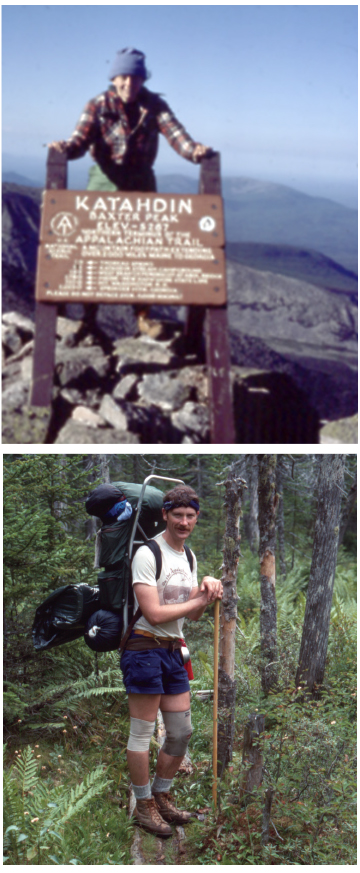
Above, In 1977 Karen Lutz hiked the entire Appalachian Trail from Georgia to the summit of Mount Katahdin in Maine. Below, Craig Dunn section hiked the entire AT, a week or two annually.
Above, Courtesy of Karen Lutz; below, Courtesy of Cindy Adams Dunn
Craig Dunn and Karen Lutz are two of my oldest friends. We go back to the late 1970s, decades before we had gray hair, artificial joints or any of the other hard-won infirmities the years have bestowed on us. We are sitting together in a restaurant, contemplating our lunch menus and catching up.
Karen is a ball of energy and action, even now in her 70s — passionate, fiercely loyal, mischievous and possessed of a side-splitting and sometimes outrageous sense of humor that often has me in stitches. Craig, on the other hand, is contemplative, thoughtful, self-effacing, with a nearly bottomless well of intelligence and patience; his serene exterior disguises a fierce dedication to the environment and a droll and ironic streak that can be wickedly funny. You somehow never think of your friends as heroic; they’re just part of the landscape of your life. But almost 50 years ago, these two were on the ground floor of a monumental achievement in the storied 80-plus-year history of the Appalachian National Scenic Trail (AT). It simply would not have happened without them.
For all three of us sitting at the table, the AT has been the stuff of dreams and great adventures. Karen thru-hiked the trail from Georgia to Maine in 1977. I did 1,400 miles of the AT in 1981 and several hundred miles of it in later years. Craig has hiked all of it in sections, a week or two annually. The three of us are founding members of the Cumberland Valley Appalachian Trail Club that maintains much of the trail in Cumberland County. The AT annually inspires a couple thousand hearty souls to walk the whole 2,200-mile route, and it is one of the most dearly loved and heavily used footpaths in North America every single day of the year.
After the waitress takes our orders, I ask Craig, “Do you remember when the idea of relocating the trail in the Cumberland Valley was actually discussed?”
As befits his character, Craig pauses to reflect before speaking. “I think in 1978, right after the passage of the Act.”
The “Act” he refers to is H.R. 8803, “An Act to Amend the National Trails System Act,” signed by President Jimmy Carter and known colloquially as the “Appalachian Trail Act.” This landmark piece of legislation profoundly amended the original 1968 National Trails System Act and directed the National Park Service (NPS) to begin acquiring land to provide a protective corridor for the Appalachian Trail at a time when 60 percent or so of the nation’s first National Scenic Trail was on private lands and unprotected from development or from being closed or encroached on. The Act also provided funds for that effort, an initial $90 million. For the first time, there was both direction and resources applied to the protection and preservation of one of America’s best ideas — a trail that traverses the spine of the Appalachians.
The Nature of the Problem
Connecticut forester, planner and landscape architect Benton MacKaye envisioned the trail in 1921 with his seminal article, “An Appalachian Trail: A Project in Regional Planning,” in the October edition of the Journal of the American Institute of Architects. He saw this long footpath through the eastern mountains as something of a utopian connection between citizens and communities and the natural world, an almost transcendentalist and expressly progressive model that reflected his New England intellectual roots.
MacKaye’s ideas caught on with the recreational hiking community, particularly in New England and elsewhere in the Appalachians. By March 1925, a gathering of regional hiking clubs assembled in Washinton, D.C., to form the Appalachian Trail Conference (ATC), a volunteer effort
to make MacKaye’s dream a reality. After the 1925 meeting, new clubs sprang up around the idea of building a Maine-to-Georgia trail, among them the Potomac Appalachian Trail Club (PATC) in 1927.
The six founding members of PATC included an attorney from Maine named Myron Avery. Energetic, fiery, blunt, pragmatic and domineering, Avery was the man most responsible for making MacKaye’s great regional vision an on-the-ground reality; however, his forceful personality clashed with MacKaye’s cerebral and careful demeanor, eventually producing a rift so profound that the two men did not speak for decades.
Avery was PATC’s first president, and in 1932, as the Depression took hold, he ascended to the chair of the Appalachian Trail Conference. In this role he was responsible for establishing much of the AT route in Pennsylvania and helping to form more trail clubs, including the Mountain Club of Maryland (MCM) in 1934.
Operating out of Baltimore, MCM was given the responsibility for establishing, building and maintaining portions of the AT in southern Pennsylvania, including some of the mileage in Cumberland County. During the Depression, volunteer trail club members, often working with Civilian Conservation Corps crews and state and federal land managers, completed a continuous route connecting Springer Mountain in Georgia with Mount Katahdin in Maine. By 1937 MacKaye’s inspirational idea became a real footpath.
Like all inspirational ideas, there were aspects of Benton MacKaye’s vision that were more difficult and complex than others. One of the hardest problems to solve was in Cumberland County, Pennsylvania, halfway between Georgia and Maine, and it had its source in regional geography and geological history.
What are collectively referred to as “the Appalachians” are, in reality, a mass of ancient uplands with different geological origins, ages and names. The easternmost mass of mountains is known as the Blue Ridge and by various other names like the Smokies and Unicoi ranges in the Carolina–Tennessee borderlands or the South Mountain in Pennsylvania and Maryland.
The Blue Ridge is formed on the bones of extinct volcanoes that are impossibly old. The eruptions that formed them occurred in episodes that spanned a period between 500 million and 250 million years ago, but there are basement rocks at the core of the range that are a billion years old. The Blue Ridge rises in Georgia, and its northern terminus is in Pennsylvania.
West of the Blue Ridge, the Ridge-and-Valley Appalachians formed some 250 million years ago as the movement of tectonic plates compressed the mostly sedimentary bedrock to twist accordion-like in endless folds of ridgetops and intervening hollows from what’s now north Alabama into New York.
These two subranges of the Appalachians are separated from each other by what is known as the Great Valley, a fertile intermountain limestone valley that can be traced from the vicinity of Roanoke, Virginia, all the way north to the Delaware River. Between the Susquehanna River and the Mason–Dixon line, it’s known as the Cumberland Valley, and it was within the Cumberland Valley that the Appalachian Trail met one of its greatest challenges as a continuous footpath from Georgia to Maine.
If the trail were to reach the volcanic mountains of New England on its northward route, it had to somehow leave the northern Blue Ridge, traverse the Great Valley, and enter the Ridge-and-Valley mountains. MacKaye’s early maps of the proposed trail depict the route doing that near Harpers Ferry, following the C&O Canal towpath west to the Tuscarora Mountain, then moving northward into Pennsylvania. On the ground, scouting by Avery convinced him that the valley should be traversed further north. Other volunteers and proponents had other routes in mind, but Avery’s indomitable force of will won out.
In 1930 Avery announced that the new AT would blaze a 12-mile path across the Cumberland Valley in Pennsylvania, a route which was almost entirely in private ownership as farms, suburbs and small but growing communities.
As the first iteration of the Appalachian Trail was built in the 1930s, the route across the Cumberland Valley followed a network of what were then very rural roads connecting the foot of the South Mountain near Boiling Springs to the Kittatinny Ridge at Lambs Gap on the Perry County line. The route was never ideal. It was paved macadam and shade was at a premium, as was potable water, but motorized traffic in the 1930s was light, and the route provided a reasonably safe and expeditious connection between the south and north.
After the Second World War, returning soldiers pitched in to volunteer and help rebuild the AT, much of which had fallen into disrepair during the conflict. They also started families and built a booming economy, and Cumberland County began to grow as suburbs were built and manufacturing, retail businesses and transportation facilities began to consume the rural landscape. The Cumberland Valley road-walk became increasingly dangerous, and I can personally attest that it was hot, dry and miserable. Close calls with vehicles were a near daily occurrence for backpackers traversing the valley, and blistered feet from exposed asphalt was the norm.
Options to move the trail to safer and protected locations became more limited with each passing year. There was some danger that the dream of a continuous AT might end in Pennsylvania. By the 1970s it was the longest remaining paved stretch of the trail. When the Appalachian Trail Act passed in 1978, one of the locations given the highest priority for preservation and relocation was the Cumberland Valley.
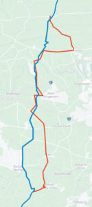
The Appalachian Trail in the Cumberland Valleye: the original route is in red and the new route is in blue.
Pennsylvania Historical & Museum Commission
Looking for a Route
Those priorities were established within a brand-new unit of the National Park Service. One of the consequences of the original National Trails System Act of 1968 was to engender some tension between the vast community of trail volunteers from Georgia to Maine and NPS. The volunteers celebrated the formal designation of National Trails, especially their beloved AT. NPS saw it, in some ways correctly, as an unfunded mandate.
In the mid-1970s the redoubtable Dave Ritchie, deputy director of the Northeast Regional Office of NPS in Boston began pushing the agency to establish a park unit devoted to the Appalachian Trail. Always something of an iconoclast, Ritchie was a New Jersey–born Quaker and a product of Friends schools who became a Marine Corps pilot and spent much of his life pushing hard against the grain.
Ritchie was not an adherent to the agency’s general disdain for the trail, and he became a passionate advocate for the volunteers and their mission to protect the AT. He was the right man at the right time. Through his support and advocacy, NPS established an Appalachian Trail Park Office in 1976 at Harpers Ferry, and Ritchie ran that office, initially with a single assistant, for 11 years.
Ritchie put into practice many of the principles that guide the management of the AT to this day. That management is based on what’s sometimes called the “three-legged stool” that supports the AT. This three-way partnership assigns responsibility for funding, planning and legal oversight to the NPS. It assigns ATC the responsibility for coordinating the activities of the 30 local maintaining clubs and for serving as their liaison with NPS. The most important responsibility, that of actually building, maintaining and monitoring the trail itself, fell to the volunteer community.
In the mid-70s, before the passage of the Act, MCM club members, along with members of the Harrisburg-based Susquehanna Appalachian Trail Club (SATC), PATC, and other community members and state officials began looking for other routes to cross the Cumberland Valley.
In 1978 Cumberland County formed a committee to develop some plausible alternatives to the status quo. The committee included elected officials, landowners and county residents, among them Craig Dunn. They developed three possible alternatives. One would leave the trail on the road network but move it to an adjacent cinder path. Another proposed route would involve an abandoned railroad line closer to Mechanicsburg that seemed impractical because of strident landowner opposition. The third was a route that generally followed a geological feature called Ironstone Ridge that traversed the valley south to north. Ironstone Ridge is a crack in the limestone bedrock that allowed an upwelling of igneous rock, a dyke of extraordinarily tough greenstone, to appear at the surface. Ironstone Ridge traditionally formed the boundaries between farm properties and fields since it was too rocky to farm and was mostly preserved as wood lines and marginal pastureland. It was this “Ridge Route” that showed the greatest promise.
After the passage of the Act made funding to acquire corridor land available, Dave Ritchie stuck by his most important principle of trail management and asked the volunteer community to take the lead in scouting the route and talking to local landowners. That role fell to MCM, then the maintaining club responsible for the Cumberland Valley, and specifically to MCM’s indefatigable leader, sometime club president and club archivist Thurston Griggs.
Griggs was a remarkable and truly larger-than-life character whom I got to know pretty well in the 1990s. A college professor at the University of Maryland, Baltimore, and an energetic hiker and trail maintainer into his 90s, he was inducted into the Appalachian Trail Hall of Fame by the Appalachian Trail Museum in 2020. Griggs was loquacious, passionate and deeply knowledgeable on many subjects. He was also, as it happened, the worst possible ambassador imaginable to the generally conservative Cumberland Valley farmers and suburbanites who were going to be asked to sell land to NPS.
Griggs could be forthright and unyielding in the extreme and saw the common good of a protected trail as a societal value far more important than the value of individual property rights. In 1978 many local landowners were already skittish thanks to rumors about a coming relocation. Griggs managed to profoundly alarm and alienate a good many of them almost immediately, probably by bringing up the possibility of acquisition through condemnation early on in his discussions. His efforts had the same effect as inserting a stick into a hornet’s nest.
CANT
Sheldon Brymesser and his wife graciously ushered me into their dining room on a cold February day and offered me coffee. The expansive and lovely view south from the dining room looks across some of his farm fields toward the foot of the South Mountain. Visible to the west is a narrow turf strip leading north through fallow cornfields toward Boiling Springs. That strip is the treadway of the AT, and the trail and surrounding fields are part of the federally owned corridor of the Appalachian Trail. That land used to belong to Sheldon.
The Brymessers, like many farm families in this part of Cumberland County, share an old and deep connection to the land. They have been here since the 18th century. The haunting and lovely pastoral landscape here is the work of generations of their hands, and they’re proud of it. They also have a long connection to the Appalachian Trail. On page 122 of a 1972 National Geographic Society book on the Appalachian Trail, there is a photo of Sheldon’s dad and his brothers. Hikers have been walking by their farm since the 1930s, and as he and I looked at the photo, I told Sheldon that that book was one of the
inspirations for my own AT adventure in 1981. The first four decades of the AT’s history with Sheldon’s family were amicable.
That changed after Thurston Griggs spoke with Sheldon’s brother Stanley in 1978. Whatever was said alarmed the family and drove them to action. Sheldon told me, “My brother was really angry, and he wasn’t the only landowner around here who was!” One farmer was so put out after a discussion with Griggs that he considered pitching him into his farm pond.
Local landowners who were similarly incensed began to network and to talk to each other and to township officials. Some were, like the Brymessers, farmers who were concerned about losing productive acreage or having access to their land restricted. Others were former farmers or suburban landowners close to the bustling Carlisle Pike who were interested in developing property for residential and commercial uses in growing Cumberland County. They saw the trail as a threat to their financial nest eggs. Ronald Reagan would soon come to power in Washington and there was substantial support in many communities for smaller government. Many people agreed with the California governor that “government is the problem!” There was also outside agitation by organizations like the American Land Rights Association who saw the effort to relocate the trail as part of a broad national pattern of government land grabs. In late 1978 or early 1979 a group of 55 local landowners agreed to form a nonprofit called Citizens Against the New Trail, or CANT, among them Sheldon.
CANT became an effective lobby against the relocation of the trail. They did so by doing what the trail community had failed to do. They contacted and lobbied public officials in Washington, in Harrisburg, and at the county and township level. They messaged effectively, warning of trespass, theft and other crimes that would come from an influx of hikers. As the 1980s dawned, the prospects of ever getting the trail off the roads looked very unlikely.
Sheldon remains proud of CANT’s early accomplishments and for their support for landowner’s rights, but there’s no real animus in the man. He’s served as a township supervisor and on local planning boards for years, and he has a deep and honest understanding of the complexity of land use planning and the practical value of open space, farmland preservation and public land. He has friends and colleagues in the trail community. He is farming some of the land he used to own under a special use agreement with NPS that helps preserve traditional land uses in the AT corridor. As I left the Brymesser farm that afternoon, I took with me an understanding of the challenges of balancing public interests with individual concerns. I also left with the certainty that even in the most acrimonious debates about balancing those interests, there are often profoundly good and decent people on both sides of the argument.
The Trail Community Responds
In the early 1980s my old friends Craig Dunn and Karen Lutz began to become involved in the relocation effort in a serious way, and in the best tradition of the Appalachian Trail, as volunteers. Craig, then in his early 30s and a trust administrator in a local bank, was a member of MCM and a trail maintainer with SATC. Karen, then in her late 20s and just a couple years past her 1977 thru-hike, was the parks and recreation director for the City of York and became a volunteer and trail maintainer with MCM. They and a whole new cohort of volunteers became leaders in the effort to advocate for a relocation in the Cumberland Valley, mostly by helping to respond to CANT with some of CANT’s own tactics.
The volunteer community, at Dave Ritchie’s urging, helped build a network among like-minded constituencies, uniting the efforts of numerous regional trail and hiking clubs — Appalachian Audubon, the Central Pennsylvania Conservancy, and the American Youth Hostels Central PA Chapter — to form the Pro-Trail Coalition. Chaired by SATC president Carol Witzeman, the coalition, like CANT, made their case before local, state and federal agency officials. They attended meetings and responded to some of the overheated rhetoric and wild rumors with calm, patience and factual information. They replied to legislative inquiries. They helped produce and distribute news articles, pamphlets and letters to the editor explaining the trail community’s position. They quietly met with individual landowners, and they did much more listening than talking.
Most local, state and federal elected officials started out almost entirely hostile to the relocation, and they all needed to be mollified and persuaded, one at a time. The volunteers were patient, persistent and unrelenting, devoting literally thousands of hours to meetings, correspondence and messaging between 1980 and 1984. As Karen noted during our lunch discussion, “It literally took years to undo the damage that was done early on.” During those five years, Craig’s calm, reassuring and logical persuasiveness and Karen’s unstoppable persistence and energy helped lead the local and regional effort to find a way forward.
The full-court press paid off. By 1984 NPS felt that enough progress had been made toward public and political support for solving the problem that they began an environmental assessment of the three alternatives proposed for the Cumberland Valley relocation. It was then that the volunteer push really went into high gear. It was obvious that the only way that the trail would get relocated was with overwhelming public support.
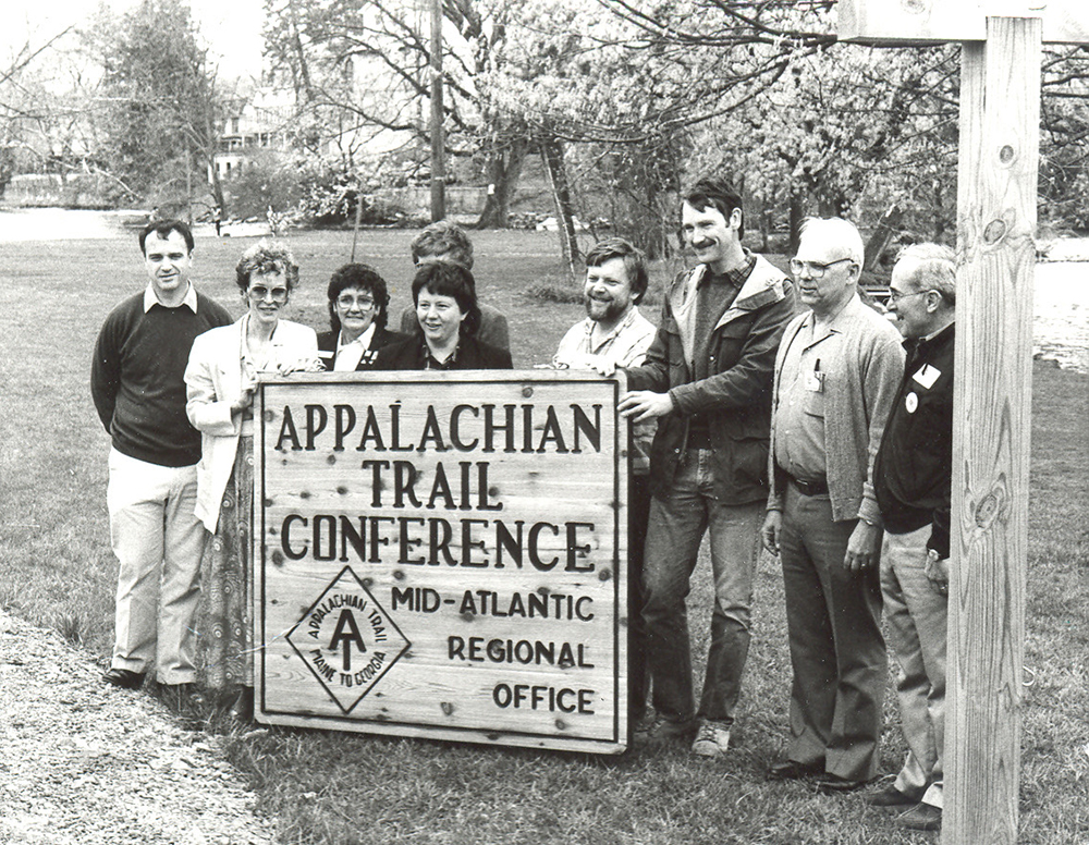
Karen Lutz, fourth from left, and Craig Dunn, third from right, at the opening of the Appalachian Trail Conference’s Mid-Atlantic Regional Office in Boiling Springs, April 22, 1989.
Courtesy of Karen Lutz
Volunteers wrote editorials and gave interviews. Craig, Karen and many other volunteers worked every connection they could think of for letters of support. The letters went to NPS and were copied to most of Pennsylvania’s congressional delegation and its senators. Craig retained photocopies of all the letters in his files. They are from some of central Pennsylvania’s most well-known and well-off residents and from ordinary people, from members of both political parties, from businesses, nonprofits and private citizens. Most of them support the relocation. The stack of letters is nearly an inch thick. CANT and other opposing interests and organizations weren’t quiet either, and they too wrote, spoke and organized in opposition. Through the spring and summer of 1985, NPS gathered public comment and then convened a public hearing to be held in late August at Cumberland Valley High School’s auditorium.
The public meeting was held on Thursday, August 29. There may have been as many as 400 people in attendance. Dozens of proponents and opposition members spoke, including Sheldon, Craig and Karen, as well as Congressman Bill Goodling, a fierce opponent of the Ridge Route relocation, and prominent local businessman Fran Masland Jr., an equally strong proponent. The crowd was raucous with cheers, jeers and catcalls echoing through the packed auditorium in response to many speakers. A panel that included Dave Ritchie, other agency staff and elected officials listened carefully for hours. Craig and Karen described it as one of the most fraught and exhausting public events either of them ever witnessed. It was, without a doubt, a turning point that demonstrated conclusively that support for relocating the trail to a better and safer route was no longer a minority position. The Harrisburg Evening News headline on Friday read, “Appalachian Trail Hearing Ends in a Draw.” The decision was now in the hands of the National Park Service and its new director, William Penn Mott.
Decision
Bill Mott was 76 years old when President Reagan nominated him for the directorship of NPS. He’d already had a long career in public service in California running one of the nation’s largest state park systems. Given his age, and his appointment at the beginning of a second presidential term, there were probably many people who viewed him as a kindly and benevolent caretaker who wouldn’t make any waves before riding off into the sunset. This proved to be a misperception. Mott’s time in the California parks made him familiar and comfortable with controversy, and in an era of state government austerity under then Governor Reagan, Mott managed to add 154,000 acres to the existing 800,000 acres of the California state parks. The American Academy for Parks and Recreation Administration characterized Bill Mott as “perhaps the most influential professional in the parks field in the last half of the twentieth century.” He did not arrive in Washington to be a caretaker.
On arriving in his new office, Mott was apprised of the controversy surrounding the Appalachian Trail route in Cumberland County. He examined the voluminous materials in his briefing packet and discussed the situation with NPS staff. He then examined a highway map and noted that Cumberland County was less than two hours from Washington by car.
With no fanfare and minimal notification to anyone, he drove to Pennsylvania alone. He walked and drove the whole trail route and chatted with a few people. He had dinner in Sheldon Brymesser’s kitchen. He returned to Washington and carefully examined the documentation and environmental assessments. On November 26, 1985, Mott announced that NPS had selected the Ironstone Ridge alternative for the relocation of the Appalachian National Scenic Trail through the Cumberland Valley. Special provisions would be made to ensure that farming would continue on federally owned parcels, and condemnation of private land was to be a last resort only. Of the more than 100 separate land parcels eventually acquired for the new route, only two were acquired through condemnation.
A New Trail in an Old Place
As the expression goes, the rest is history. As land parcels were acquired by NPS starting in 1986, the AT footpath was gradually moved to the pastoral setting of Ironstone Ridge, with the last portions being constructed in 1990. Karen and Craig were among the core group who founded what is now the Cumberland Valley Appalachian Trail Club (CVATC) in 1990 to help maintain and improve the new footpath. Karen became the regional field representative for ATC in 1988, and she ran the ATC office in Boiling Springs until she retired in 2018. She now serves on so many nonprofit boards for so many regional and statewide environmental and land management groups that I’m not sure how she does it all. Craig remains the trailmaster for CVATC, organizing and overseeing monthly maintenance and trail improvement projects from the summit of Center Point Knob on South Mountain to the top of Kittatinny Ridge at the Perry County line. Both deny any claim of being heroic, but there’s a lot of us around who know better. All three of us still get out and hike every chance we get.
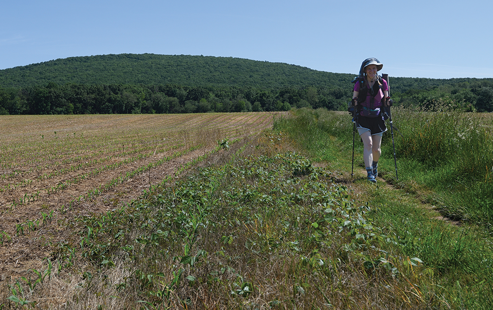
A thru-hiker arrives in the Cumberland Valley from Georgia.
Photo, Pennsylvania Historical & Museum Commission
The AT route in the Cumberland Valley remains an unqualified success. Cumberland County’s Master Plan notes that the effects of the AT corridor include increased property values, huge amounts of tourism income and recreation spending, and businesses opening in the county thanks to the higher quality of life that public land brings. None of the crime and bad behavior predicted by relocation opponents ever occurred, and rather than stifling agriculture, the trail corridor has preserved some of the only surviving stretches of farmed land in parts of the county that are being overwhelmed by residential development and trucking plazas. It is a quiet green refuge for local residents escaping the suburbs and bustle of the capital area, and it’s a gentle and lovely change of pace for long-distance backpackers as they move from one mountain range to the next.
As I was wrapping up this manuscript on a lovely April Sunday afternoon, I took a break for a short jog on the AT just north of my home in Boiling Springs. Starting up a hill, I found myself running through what felt like Copeland’s Appalachian Spring. In the vibrant and heartbreaking green, redbuds and dogwoods were swelling and about to bloom, bloodroot and trout lilies were opening, and the air was redolent with birdsong. I came upon a backpacking husband and wife heading toward me and I stopped briefly to chat. They were roughly my age, and judging by their accents, native southerners. They had started south at the Susquehanna River in Duncannon on Friday, and they were planning on finishing their hike in Harpers Ferry on the Potomac the next weekend. I asked them how they were enjoying this stretch of the trail, and the wife broke into a broad grin. “So lovely here, so gentle and so grateful to the eye!’
I smiled back at them, “Yes ma’am. Yes, it is.”
Further Reading
Fisher, Ronald M. The Appalachian Trail. Washington, D.C.: National Geographic Society, 1972. / Johnson, Thomas R. From Dream to Reality: History of the Appalachian Trail. Harpers Ferry, WV: Appalachian Trail Conservancy, 2021. / MacKaye, Benton. “An Appalachian Trail: A Project in Regional Planning.” Journal of the American Institute of Architects 9 (October 1921): 325–30.
Joe Baker is an archaeologist, writer and editor. His most recent articles for Pennsylvania Heritage are “Lost and Found: The Rediscovery of Colonial Fort Halifax” (Spring 2023), “The Source: Native American Quarries in Pennsylvania” (Fall 2021), and “High on a Mountain: Pennsylvania’s Legacy of Country Music” (Winter 2020).